三维虚拟电子沙盘数字沙盘态势推演教程第12课
设置system.ini 如下内容
Server=122.112.229.220
user=GisTest
Password=chinamtouch.com
该数据库中只提供 成都市火车南站附近的数据请注意,104.0648,30.61658
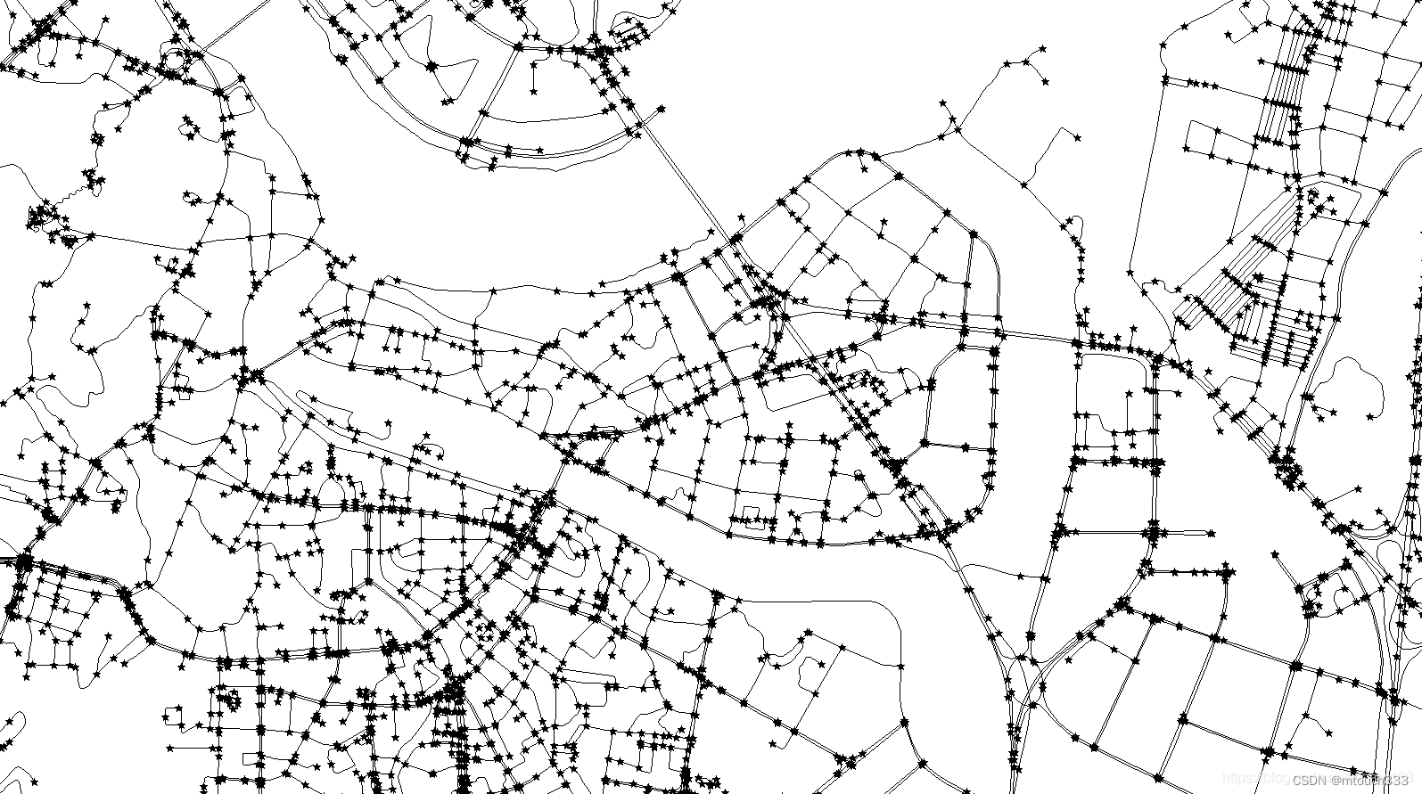
SDK中自带了一套 导航系统,用的是比较详细的导航数据,你们懂的,修正了一下在使用互联网服务器时候的一个BUG,请在使用这部分功能时务必下载上面地址中的核心更新包覆盖。 截图如下:
该导航图为切片导航图。年份嘛,你们懂的,另外导航系统为线程异步工作。因需要数据库支持,所以如果你是用的互联网服务器
导航算法得到路径的时间会有所增长,建议是把数据库下载到本地才可以看到真实的导航算法速度。
导航算法在单独的ShortRoad.dll中(可独立使用,担需要相关数据文件。)导航算法可根据权值进行微调,目前有高速优先和,最短路径两种。
ShortRoad.ShortPath.MyPareant = this.Dispatcher; //因为导航算法为异步委托+多线程方式完成,需要一个异步委托主对象(静态)。
ShortRoad.ShortPath.chuslhi(); //初始化数据(静态)
MyShort = new ShortRoad.ShortPath();
//初始化导航类
MyShort.OnShortPath += new ShortRoad.ShortPath.PathOver(ShortPath_OnShortPath);
//导航数据回调事件
MyShort.OnPro += new ShortRoad.ShortPath.ChuLiPro(ShortPath_OnPro);
//导航算法信息事件。
MyShort.GetShortPath(BeginPoint.X, BeginPoint.Y, EndPoint.X, EndPoint.Y,false);
//获取最短路径:
参数起点经度,纬度,终点经度,纬度,是否启用高速优先。
路径回调事件:
void ShortPath_OnShortPath(System.Collections.Generic.Dictionary<string, System.Collections.Generic.List<System.Drawing.PointF>> value,System.Windows.Point bx,System.Windows.Point ey)
{ double Totolength = 0;
Pareant.PlayPath.Add(new Point3D(BeginPoint.X, BeginPoint.Y, 0));
foreach (string key in value.Keys)
{
Totolength += Convert.ToDouble(key.Split('#')[1].Split(',')[12]);
foreach (System.Drawing.PointF y1 in value[key])
{
Pareant.PlayPath.Add(new Point3D(y1.X, y1.Y, 0));
}
}
}
事件参数1:System.Collections.Generic.Dictionary<string,System.Collections.Generic.List<System.Drawing.PointF>>
存放有所有的路径数据 KEY为路径详细信息内容如下(Value中为经纬度数据):
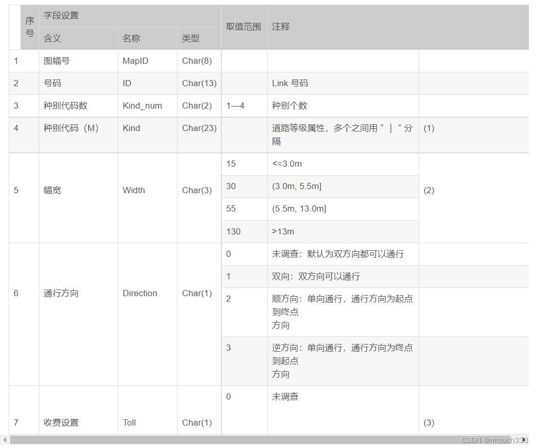
"清江东路#464400 , 49559714 , 1 , 0302 , 130 , 3 , 2 , 1 , , 47106369 , 5880354 , 3 , 0.012 , 1 , 1 , , 0 , 1 , 0 , 510105 , 510105 , 1 , , , 5 , , 4 , 3 , 11110001110000000000000000000000 , 0 , 0 , , , , 600 , , 1 , 1 , , 清江东路"
该KEY描述了这条路的所有信息。可参看下表:

下面上代码,先要引用shortroad.dll
ShortRoad.ShortPath.MyPareant = this.Dispatcher; //因为导航算法为异步委托+多线程方式完成,需要一个异步委托主对象(静态)。
ShortRoad.ShortPath.chuslhi(); //初始化数据(静态)
MyShort = new ShortRoad.ShortPath();
//初始化导航类
MyShort.OnShortPath += this.MyShort_OnShortPath;
//导航数据回调事件
MyShort.OnPro += MyShort_OnPro;
//导航算法信息事件。
#region 导航系统
System.Windows.Point FirstJW= new System.Windows.Point();
System.Windows.Point secJW = new System.Windows.Point();
private void Button_Click_15(object sender, RoutedEventArgs e)
{
gis3d.State = GisLib.WindowsMT.GisState.获取经纬度;
gis3d.GetJWEvent += Gis3d_GetJWEvent2;
}
private void Gis3d_GetJWEvent2(System.Windows.Media.Media3D.Point3D value)
{
gis3d.GetJWEvent -= Gis3d_GetJWEvent2;
FirstJW = new System.Windows.Point(value.X, value.Y);
gis3d.State = GisLib.WindowsMT.GisState.漫游;
}
private void Button_Click_16(object sender, RoutedEventArgs e)
{
gis3d.State = GisLib.WindowsMT.GisState.获取经纬度;
gis3d.GetJWEvent += Gis3d_GetJWEvent3;
}
private void Gis3d_GetJWEvent3(System.Windows.Media.Media3D.Point3D value)
{
gis3d.GetJWEvent -= Gis3d_GetJWEvent2;
secJW = new System.Windows.Point(value.X, value.Y);
MyShort.GetShortPath(FirstJW.X, FirstJW.Y, secJW.X, secJW.Y, true);
gis3d.State = GisLib.WindowsMT.GisState.漫游;
}
private void MyShort_OnPro(string value)
{
FirstShort.Content = value;
}
private void MyShort_OnShortPath(Dictionary<string, List<PointF>> value, System.Windows.Point mbegin, System.Windows.Point mend)
{
if (value == null)
return;
if (value.Count == 0)
return;
List<Point3D> PlayPath = new List<Point3D>();
double Totolength = 0;
// Pareant.PlayPath.Add(new Point3D(BeginPoint.X, BeginPoint.Y, 0));
foreach (string key in value.Keys)
{
if (key.Length > 12)
{
if (key.Split('#').Length >= 2)
Totolength += Convert.ToDouble(key.Split('#')[1].Split(',')[12]);
}
foreach (System.Drawing.PointF y1 in value[key])
{
PlayPath.Add(new Point3D(y1.X, y1.Y, 0));
}
}
PlayPath.Add(new Point3D(secJW.X, secJW.Y, 0));
Random t1 = new System.Random();
System.Windows.Media.Color pp = new System.Windows.Media.Color();
pp = Colors.Red;
//调用SDK提供的画路方法把路画出来
gis3d.RemoveShotPath("导航路径");
gis3d.DrawShortPath(PlayPath, "导航路径", pp, true);
}
#endregion
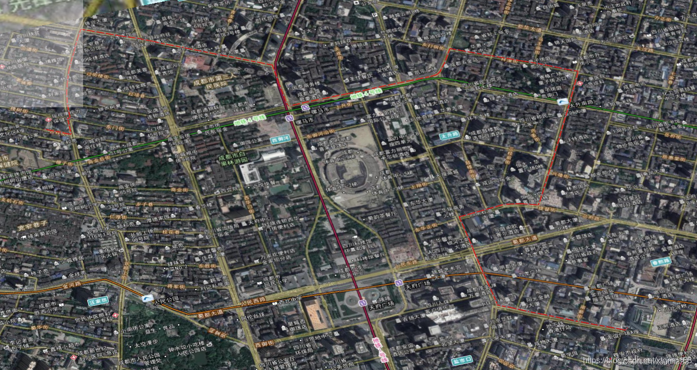
效果如下:再三强调数据库配合,所以用互联网服务器的时候。在计算时会比较慢,担因为使用的是线程模式,所以不影响主进程做其它事。SDK自带的drashortpath方法支持自动抽稀,可以显示很长的导航路线。

)
)


)


)
)

—— 查询执行(数据定义语句执行)】)