1.地面站只需要知道地面站的经纬高。
// Define the location of the facility using cartographic coordinates.var location = new Cartographic(Trig.DegreesToRadians(-75.596766667), Trig.DegreesToRadians(40.0388333333), 0.0);2.创建地面站
创建方式和卫星一样生成对象,添加模型,设置各种属性
最后生成czml
private void CreateFacility()
{// Define the location of the facility using cartographic coordinates.var location = new Cartographic(Trig.DegreesToRadians(-75.596766667), Trig.DegreesToRadians(40.0388333333), 0.0);var locationPoint = new PointCartographic(m_earth, location);m_facility = new Platform{Name = "AGI HQ",LocationPoint = locationPoint,// Orient the facility using East-North-Up (ENU) axes.OrientationAxes = new AxesEastNorthUp(m_earth, locationPoint),};// Set the identifier for the facility in the CZML document. m_facility.Extensions.Add(new IdentifierExtension("AGI"));// Configure a glTF model for the facility.m_facility.Extensions.Add(new ModelGraphicsExtension(new ModelGraphics{// Link to a binary glTF file.Model = new CesiumResource(GetModelUri("facility.glb"), CesiumResourceBehavior.LinkTo),RunAnimations = false,HeightReference = CesiumHeightReference.ClampToGround,}));// Configure label for AGI HQ.m_facility.Extensions.Add(new LabelGraphicsExtension(new LabelGraphics{Text = m_facility.Name,FillColor = Color.White,// Only show label when camera is far enough from the satellite,// to avoid visually clashing with the model.DistanceDisplayCondition = new Bounds(1000.0, double.MaxValue),HeightReference = CesiumHeightReference.ClampToGround,}));
}
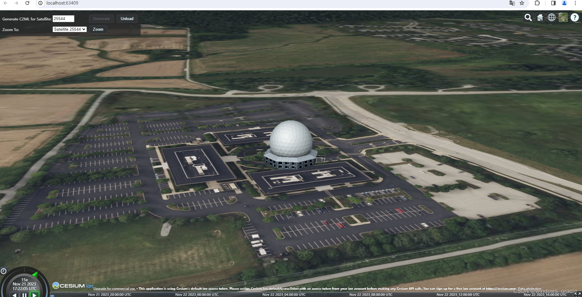
实现效果

3.卫星和地面可见性
可见性主要通过 CentralBodyObstructionConstraint这个算法判断。

是一种不考虑地形和海平面的一种理想条件。
private void CreateSatelliteAccessLink()
{m_satelliteFacilityLink = new LinkInstantaneous(m_facility, m_satellite);// Set the identifier for the link in the CZML document. m_satelliteFacilityLink.Extensions.Add(new IdentifierExtension("SatelliteFacilityAccess"));// Specify how access should be constrained.  In this case, // access will only exist when no part of the earth is between AGI HQ and the satellite.m_accessQuery = new CentralBodyObstructionConstraint(m_satelliteFacilityLink, m_earth);// Configure graphical display of the access link.m_satelliteFacilityLink.Extensions.Add(new LinkGraphicsExtension(new LinkGraphics{// Show the access link only when access is satisfied.Show = new AccessQueryCesiumProperty<bool>(m_accessQuery, true, false, false),Material = new SolidColorMaterialGraphics(Color.Yellow),}));
}
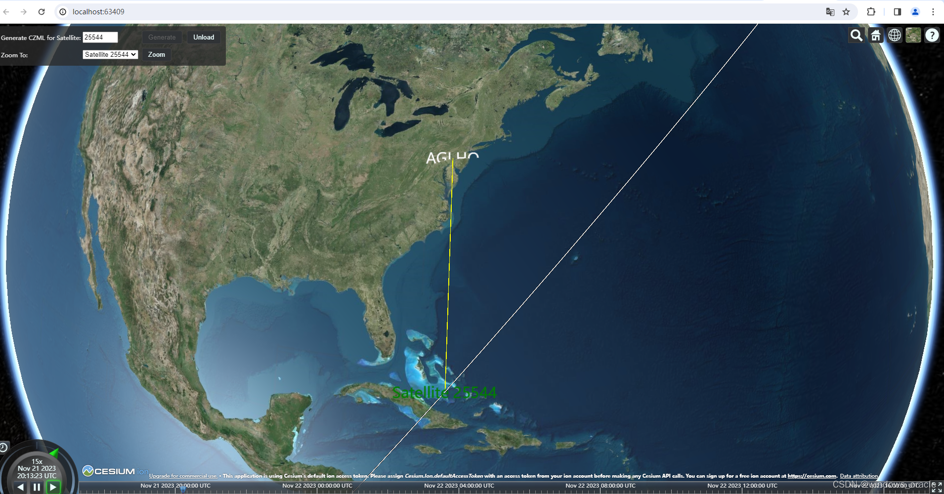
效果

以上就是本次的学习内容。
 NodeJS 16 和 Vue)

)
)


)


![[pyqt5]PyQt5之如何设置QWidget窗口背景图片问题](http://pic.xiahunao.cn/[pyqt5]PyQt5之如何设置QWidget窗口背景图片问题)

)
)

)


